


 >
>
Text:
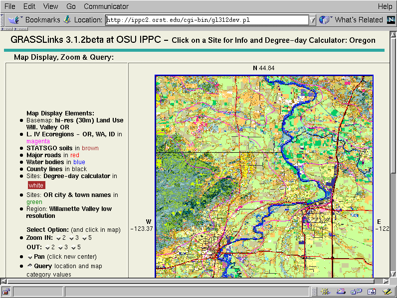
After zooming in once at a factor of 5, we see the mid-Willamette Valley, with Corvallis in the lower left. At this zoom level, you can see clearly the land use and overlaying vector and site layers, such as roads, water, county boundaries, and weather stations.