


 >
>
Text:
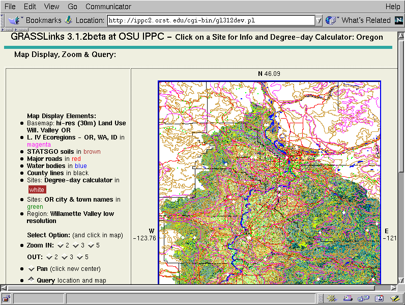
Here we display several vector (line) data layers overlayed on the high-resolution (30 meter) land use map of the Willamette Valley of Oregon. One can zoom, pan, and query all of the maplayers on display, and bring up any available database connections to the maplayers