


 >
>
Text:
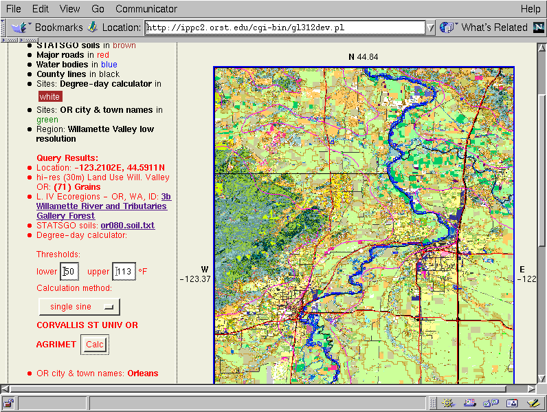
We can query these maplayers by clicking in the map, getting back (within a couple of seconds) any associated values for that point, in this case we get back the lat/long coordinates, the land use (Grains), the level IV ecoregion category (further linked to a database record), a link to the STATSGO soils database, a degree-day calculator form for the nearest weather station selected, and the nearest city or town name. We can continue to query the map, zoom in further, pan around, and perform more extensive analyses.