


 >
>
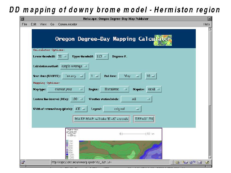
Text:
To serve these needs, we have a general purpose degree-day calculator integrated with a GIS (geographic information system) which can dynamically create maps of degree-days. The calculator options are fairly standard, with thresholds, calculation method, and dates of interest. In addition, you may select the current year, previous year, or historical average temperature data. Also, you may select to compute the degree-day deviations between the current year and previous year, or the deviations between the current year and the historical average values. Then there are several mapping options, such as the region, the size of the map, weather station labels, contour line interval, and legend type. Here notice we have already selected the "Make Map" button, and after 20 or so seconds we get back the smaller version of the map, which we then click to get back the larger copy.