| Projects: Name / Description: |
GRASS Location | GRASSLinks Project Code |
| Spearfish GRASS example dataset | spearfish | x |
| Global GRASS example dataset | global | y |
| RASTER FILES: Name / Description: Click filename to view thumbnail |
Metadata Available? | GRASSLinks Project(s): |
|
Ecoregions |
Y | y |
|
Elevation DEM |
Y | x |
|
Geology |
Y | x |
|
Landuse |
Y | x |
|
Nations |
Y | y |
|
Nations 2 |
Y | y |
|
Soil Class |
Y | y |
|
Soil Texture |
Y | y |
|
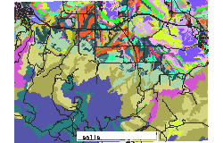
Soils |
Y | x |
|
Soils PH |
Y | x |
|
Spot Image |
Y | x |
|
Vegetation 1 degree res. |
Y | y |
|
Vegetation Cover |
Y | y |
| VECTOR FILES: Name / Description Click filename to view thumbnail |
Metadata Available? | GRASSLinks Project(s): |
| Coastlines |
N | y |
| Fields |
N | x |
| Nations |
N | y |
| Rails |
N | x |
| Roads |
N | x |
| Soils |
N | x |
| streams |
N | x |
| SITES FILES: Name / Description Click filename to view thumbnail |
Metadata Available? | GRASSLinks Project(s): |
| archeological sites |
N | x |
| bug sample sites |
N | x |
Disclaimer: Use of GRASSLinks and the data accessed by it is provided as-is without any guarantees of quality, completeness, currentness, or performance. For more information, see the GRASSLinks (c) Copyright and Disclaimer.