METAR Network - other tables for WV include: All Networks, CWOP/APRS, HADS, RAWS, see our homepage.
|
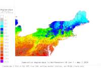
Also try the full-featured calculator/DD model | |
|
| |||||||||||||||||||||||||
|
West Virginia USA Weather Data, Plant Disease Risk and Degree-Day Models METAR Network - other tables for WV include: All Networks, CWOP/APRS, HADS, RAWS, see our homepage. | |||||||||||||||||||||||||
| |||||||||||||||||||||||||
| # | Location linked to hourly weather, plant disease models and forecasts using "Mypest Page" removed due to excessive bot activity |
County |
Re- cent data QA |
Fore- cast based virt data |
Nearby station based virt data |
Station code, links to NWS recent weather |
Links to NWS fore- casts |
Net- work Elev. (ft) |
Lat./ Long. (Dec. Deg.) |
Max-min temperature data and degree-days (click radio button to calc.) |
10 yr avgs |
30 yr avgs |
nmme fcast |
cfs fcast |
||||||||||
|---|---|---|---|---|---|---|---|---|---|---|---|---|---|---|---|---|---|---|---|---|---|---|---|---|
| 1 | Beckley Raleigh Co Mem | Raleigh |
|
na na |
na na |
|
|
2503 | 37.79500 -81.12444 |
2021
|
2020
|
2019
|
2018
|
2017
|
2016
|
AVG | AVG | nmme | cfs | |||||
| 2 | BlueFld Mercer Co Apt | Mercer |
|
na na |
na na |
|
|
2858 | 37.29556 -81.20778 |
2021
|
2020
|
2019
|
2018
|
2017
|
2016
|
AVG | AVG | nmme | cfs | |||||
| 3 | Buckhannon Upshur Co R | Randolph |
|
na na |
na na |
|
|
1634 | 39.00000 -80.26667 |
2021
|
2020
|
2019
|
2018
|
2017
|
2016
|
AVG | AVG | nmme | cfs | |||||
| 4 | Charleston Yeager Apt | Kanawha |
|
na na |
na na |
|
|
981 | 38.37917 -81.59139 |
2021
|
2020
|
2019
|
2018
|
2017
|
2016
|
AVG | AVG | nmme | cfs | |||||
| 5 | Clarksburg Benedum Apt | Harrison |
|
na na |
na na |
|
|
1201 | 39.30000 -80.22444 |
2021
|
2020
|
2019
|
2018
|
2017
|
2016
|
AVG | AVG | nmme | cfs | |||||
| 6 | ElkinsRandolph Co-Jen | Randolph |
|
na na |
na na |
|
|
1985 | 38.88528 -79.85278 |
2021
|
2020
|
2019
|
2018
|
2017
|
2016
|
AVG | AVG | nmme | cfs | |||||
| 7 | Huntington TriSt Apt | Wayne |
|
na na |
na na |
|
|
827 | 38.36500 -82.55500 |
2021
|
2020
|
2019
|
2018
|
2017
|
2016
|
AVG | AVG | nmme | cfs | |||||
| 8 | Lewisburg Greenbrier | Greenbrier |
|
na na |
na na |
|
|
2303 | 37.86667 -80.40000 |
2021
|
2020
|
2019
|
2018
|
2017
|
2016
|
AVG | AVG | nmme | cfs | |||||
| 9 | Logan County Airport | Boone County |
|
na na |
na na |
|
|
1667 | 37.85556 -81.91583 |
2021
|
2020
|
2019
|
2018
|
2017
|
2016
|
AVG | AVG | nmme | cfs | |||||
| 10 | Martinsburg Eern W Vir | Washington |
|
na na |
na na |
|
|
558 | 39.40167 -77.98417 |
2021
|
2020
|
2019
|
2018
|
2017
|
2016
|
AVG | AVG | nmme | cfs | |||||
| 11 | Morgantown MuniHart F | Monongalia |
|
na na |
na na |
|
|
1247 | 39.64917 -79.92083 |
2021
|
2020
|
2019
|
2018
|
2017
|
2016
|
AVG | AVG | nmme | cfs | |||||
| 12 | Petersburg Grant Co Ap | Grant |
|
na na |
na na |
|
|
961 | 38.98306 -79.13306 |
2021
|
2020
|
2019
|
2018
|
2017
|
2016
|
AVG | AVG | nmme | cfs | |||||
| 13 | Pineville Kee Fld Apt | Raleigh |
|
na na |
na na |
|
|
1785 | 37.60028 -81.55917 |
2021
|
2020
|
2019
|
2018
|
2017
|
2016
|
AVG | AVG | nmme | cfs | |||||
| 14 | Prkersburg MidOhio Va | Washington |
|
na na |
na na |
|
|
860 | 39.34472 -81.43917 |
2021
|
2020
|
2019
|
2018
|
2017
|
2016
|
AVG | AVG | nmme | cfs | |||||
| 15 | Sutton Braxton Co Apt | Braxton Coun |
|
na na |
na na |
|
|
1270 | 38.68667 -80.65167 | nmme | cfs | |||||||||||||
| 16 | Wheeling Ohio Co Apt | Jefferson |
|
na na |
na na |
|
|
1194 | 40.17028 -80.64417 |
2021
|
2020
|
2019
|
2018
|
2017
|
2016
|
AVG | AVG | nmme | cfs | |||||
[USPEST.ORG/WEA Home]
[Intro]
[US DD Mapmaker]
[Main Table Index]
[Links]


|