|
Preliminary Cumulative Degree-Day Maps of Oregon
derived from PRISM temperature maps and
degree-day calculations from 127 sites in Oregon
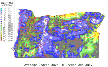
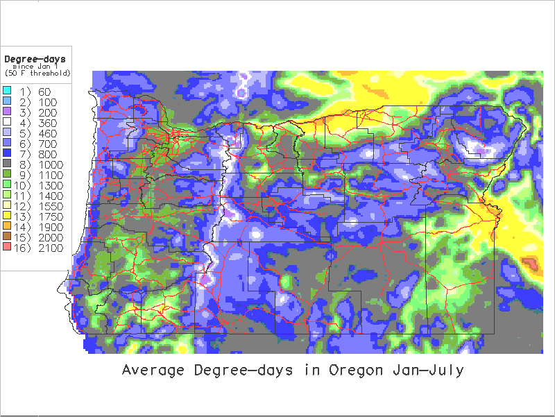
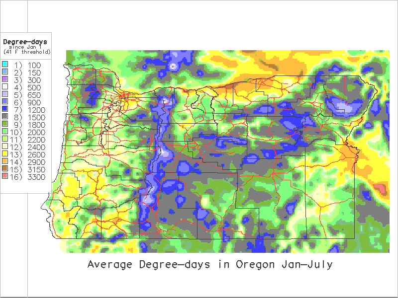
Map of average Degree-days Jan-July
Contents

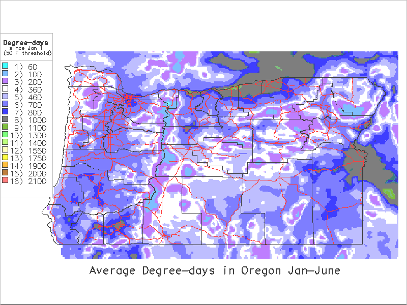
Series created using a 50 degrees F. lower threshold:
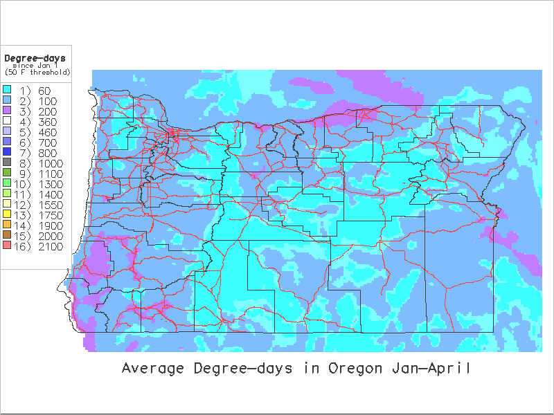
 Jan 1 - April 30 Jan 1 - April 30
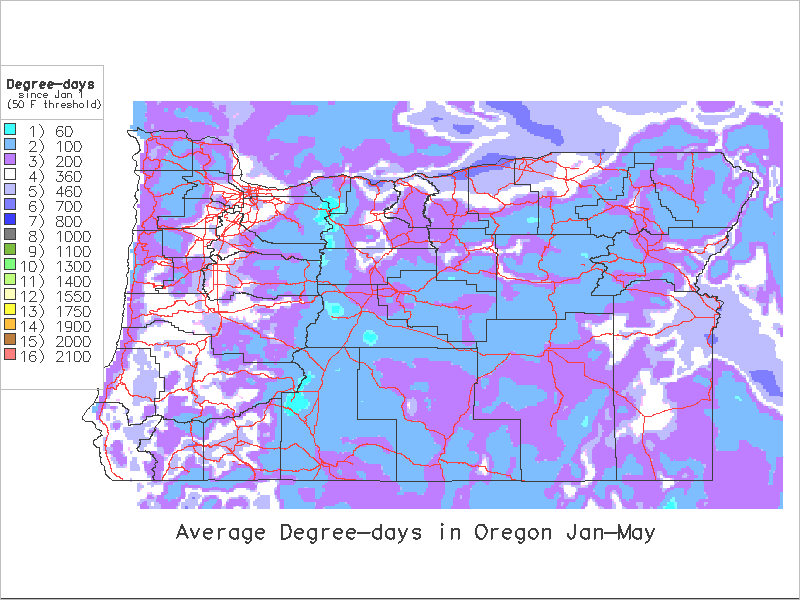
 Jan 1 - May 31 Jan 1 - May 31
 Jan 1 - June 30 Jan 1 - June 30
 Jan 1- July 31 Jan 1- July 31
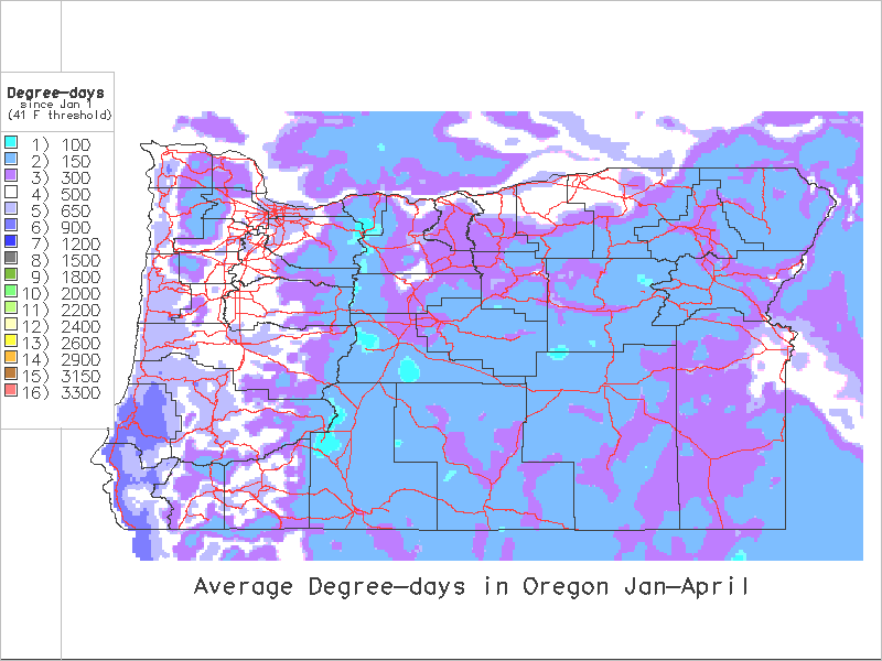
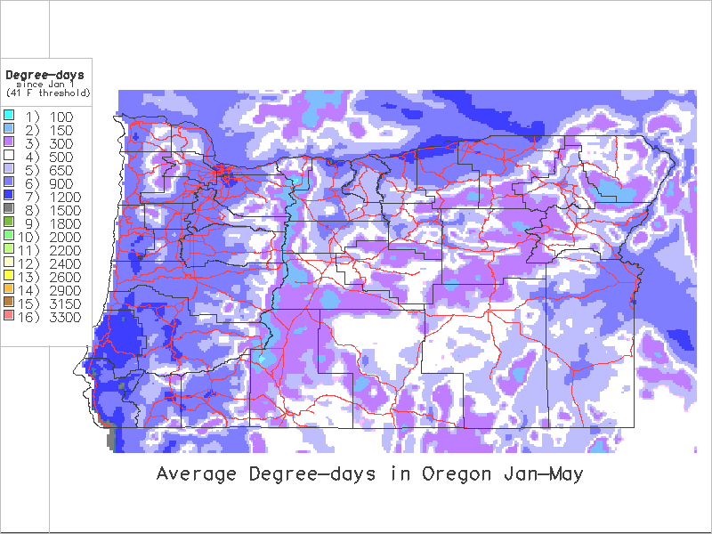
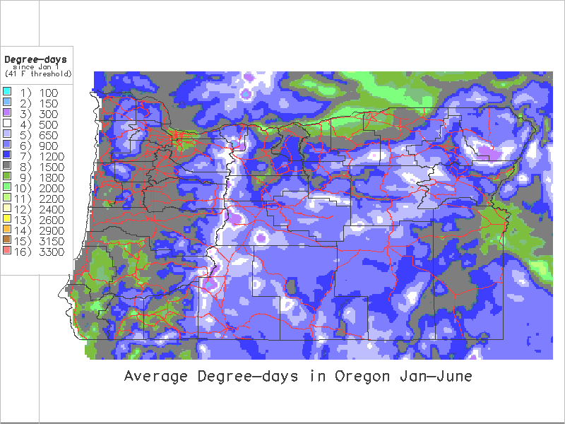
Series created using a 41 degrees F. lower threshold:
Jan 1 - April 30
Jan 1 - May 31
Jan 1 - June 30
Jan 1 - July 31
 Brief summary of methods used to create degree-day maps Brief summary of methods used to create degree-day maps
[Home]
[Intro]
[Data Table]
[Data Map]
[DD Calc]
[DD Models]
[Links]
This project funded in part by a grant from the USDA-Western Regional IPM program.
On-line since April 5, 1996
This page updated April 3, 1998
Contact Len Coop at coopl@bcc.orst.edu if you
have any questions about this information.
|
